(New York ~Boston)”Northeast corridor” in the USA (Rail Track diagram map)
投稿日 Posted on
更新日 Updated on
This page is about rail track diagram map between Boston and New York City.

アセラエクスプレスのルート 北東回廊のボストン南駅からニューヨーク・ペン駅までの線路配線図です。

(Boston ~ Nueva York) Mapas de diagramas de vías Ferrovarias de “Northeast Corridor” en los EE.UU.

這是 東北走廊 在美利堅合眾國 從波士頓 到紐約 的鐵路圖。
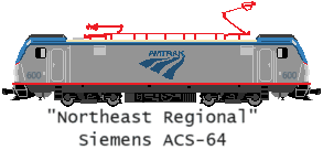
The Acela Express high-speed train and the Northeast Regional express train run between Boston South Station on the East Coast of the United States, via Providence, New Haven, and Stamford, and New York Pennsylvania Station. As of 2024, Acela Express operates at a maximum speed of 240km/h.

The section from Boston South Station to Wickford Junction Station via Providence is also used by the Massachusetts commuter train "MBTA", from New London to New Haven by the Connecticut commuter train, and from New Haven to New Rochelle by the "Metro-North Railroad". The Metro-North Railroad New Haven Line connects New Haven to New York  Grand Central Terminal, and is scheduled to begin service in the near future from New Rochelle to New York Penn Station.

In this section, except for the 11 level crossings around New London Station, there are grade-separated intersections with the road. The Acela Express travels approximately 229 miles (approximately 366 km) from Boston South Station to New York's Penn Station, taking approximately 3 hours and 45 minutes.


Leave a Reply